What I work on

Research Highlights

I develop AI systems that turn messy, real-world imagery such as social media photos, ground-level shots, satellite and nighttime data into actionable damage information after natural disasters.

EID dataset examples

EID — Earthquake Image Dataset

Earthquake Spectra, 2025

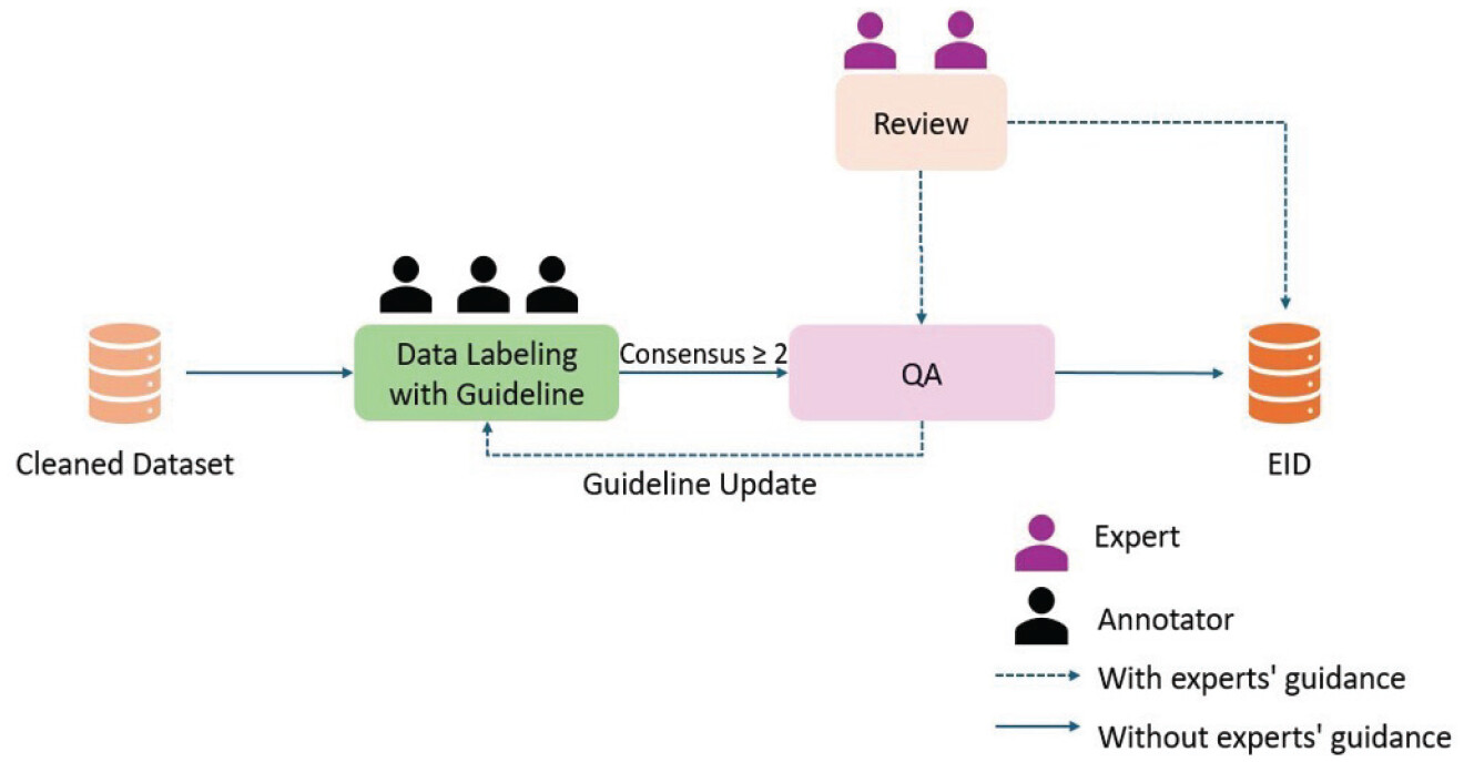
The Earthquake Image Dataset (EID) is a large-scale collection of ground-level, social-media photos labeled for earthquake damage, along with methods that make crowd-sourced imagery genuinely useful for rapid disaster response.
EIDSeg pixel-level segmentation examples

EIDSeg — Pixel-Level Damage Segmentation

AAAI 2026 · AI for Social Impact

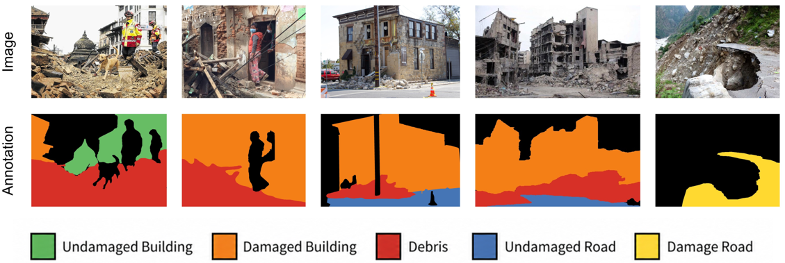
EIDSeg extends EID with pixel-level semantic segmentation labels: instead of tagging a whole photo, it marks which pixels are damaged and how severely. It is the first datasets to give fine-grained, ground-level damage masks from social-media images.

DASeg domain-adaptive segmentation pipeline

DASeg — Domain-Adaptive Segmentation

Remote Sensing, 2025

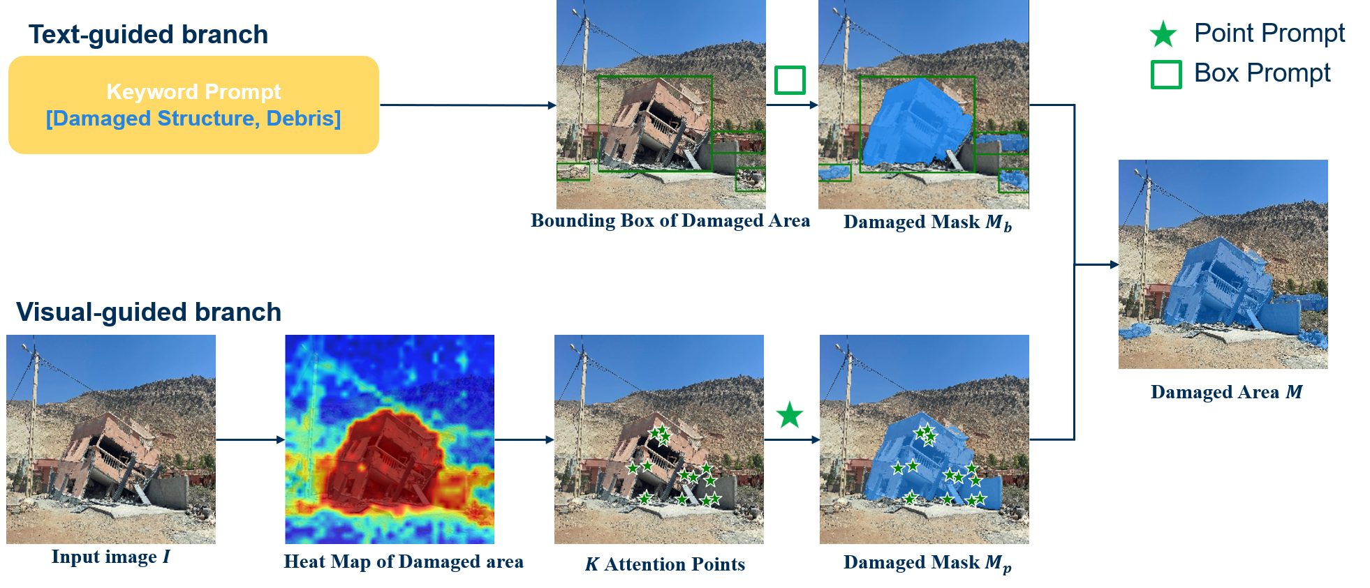
DASeg (Domain-Adaptive Segmentation) is a segmentation pipeline built on Vision Foundation Models (VFM) that adapts to new disasters with little or no labeled data, solving a key obstacle to deploying damage-assessment models in the earthquake damage.

SeismoMind framework overview

SeismoMind — LLM Reasoning for Damage

Under review · Advanced Engineering Informatics

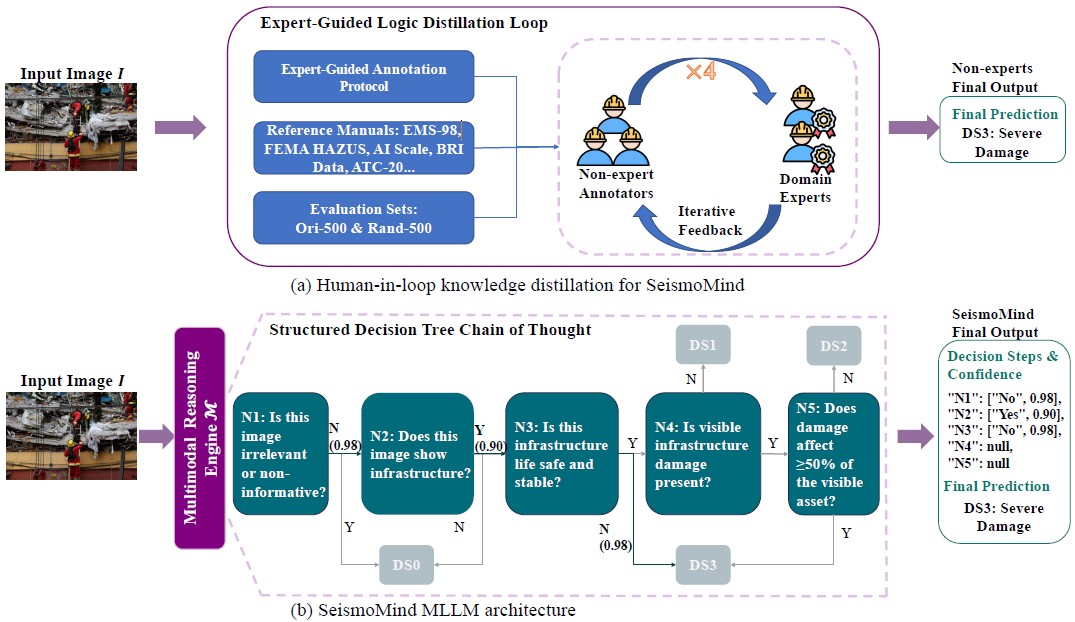
SeismoMind guides a multimodal large language model (LLM) through a decision tree to interpret post-earthquake infrastructure damage from images, producing structured, explainable assessments zero-shot, with no task-specific training.

Nighttime-light disaster damage assessment

Nighttime Light Damage Assessment

Remote Sensing, 2023

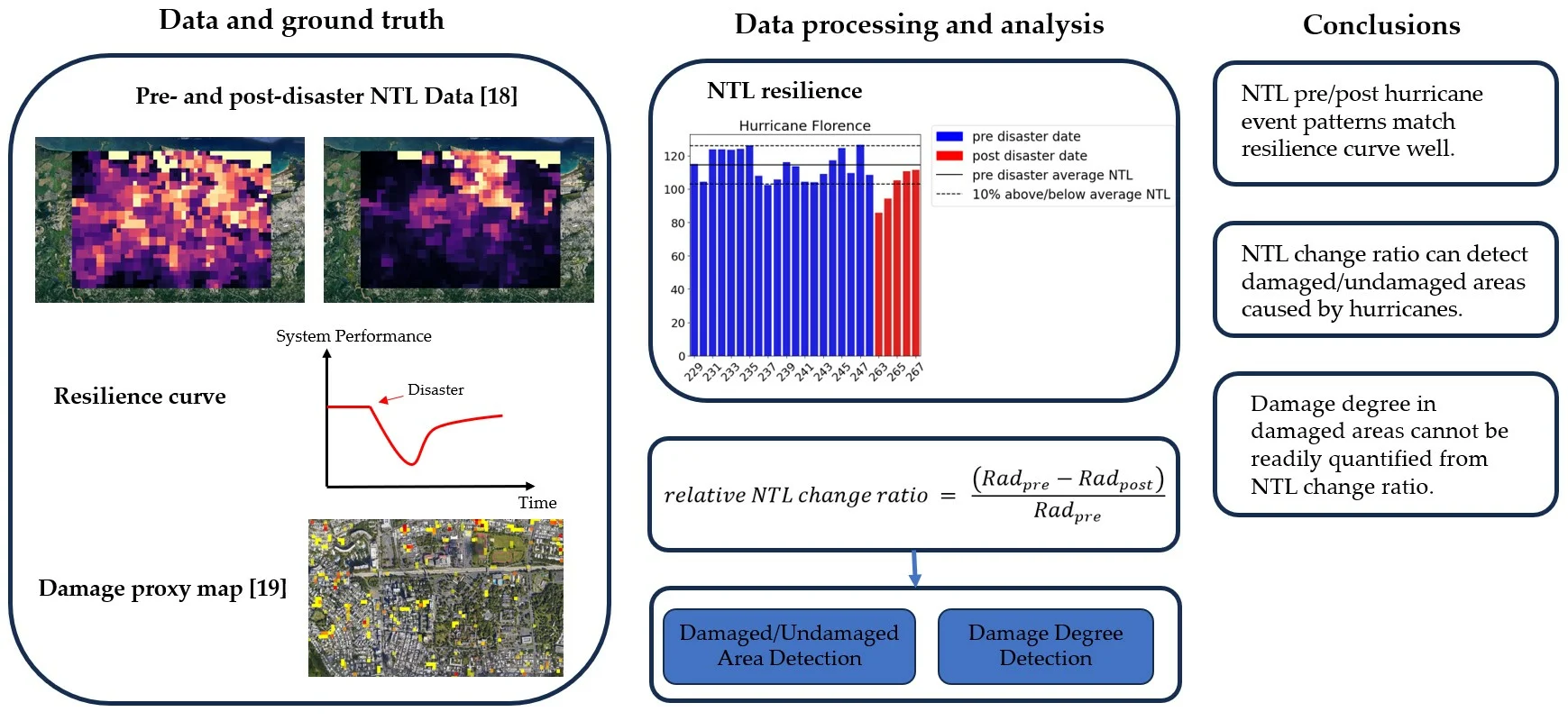
A disaster hitting a region often knocks out its lights. This work uses NASA's Black Marble nighttime-light satellite data to detect and measure that drop — assessing disaster impact at scale from space, complementing ground-level imagery.